Here, we'll see how to sort features by area and how to remove duplicate features.
Sort features by area
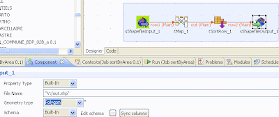
Here is the job in SDI:

1-Automatically generate the schema of the shapefile

2-Configure the input shapefile component
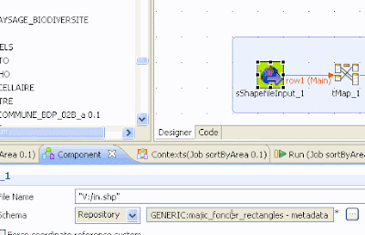 In the shema, choose the one you automatically generated.
3-Create an AREA column with the area of each feature
 In the expression, type
GeometryOperation.GETAREA(row1.the_geom)
4-Sort features by area
 Choose an ascendant order so that the biggest features will be in the indexed first
5-Generate the output shapefile
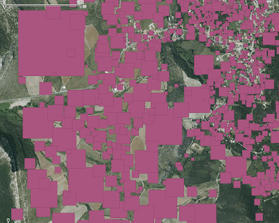
Here is an example of output result:
Remove duplicates
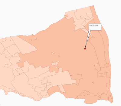 In this image we set transparency so as to enhance duplicate fatures.
You'd like to clean up this file, removing the duplicate features.
I's very simple to accomplish in Talend SDI:
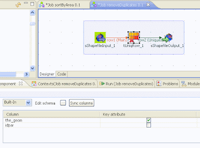
--
Here, we reviewed two very simple operations in Talend SDI, yet very easy to create.
They are very simple to accomplish on a PostgreSQL/PostGIS Database but not very handy on flat files like shapeFiles. In this case, Talend/SDI is very useful.
Here is the link if you wish to download the spatial ETL Talend/SDI:
http://www.spatialdataintegrator.com/

Hello,
RépondreSupprimerThe first of all i want to thank you for sharing this topic.
I want to ask you if you have a documentation about spatial data integrator because i use it it now but i don't find a interesting information on the internet.
Thanks,
Rabi
Hello,
RépondreSupprimerI imagine you already know how to use Talend, qhich is a pre-requisite. If not, you can find interesting tutos on Talend's website.
The problem is that the tutos you'll find on the web are mostly in French
Here are a few links:
- https://github.com/talend-spatial/talend-spatial/wiki : use cases
- http://sig.cenlr.org/_media/outils/tos_sdi/forumtic2010_sditos.pdf : a use case in French from the cenlr in Hérault
- http://www.slideshare.net/mathieuraj/prsentation-spatial-data-integrator : a keynote full of images to get inspired of.
- http://georezo.net/wiki/main/logiciels/sdi/start : a wiki page in french
Best,
Mathieu
I forgot to mention the support forum which is the best place to get answers on specific questions:
RépondreSupprimerhttp://www.talendforge.org/forum/viewforum.php?id=9
Sometimes the developers themselves answer the users.