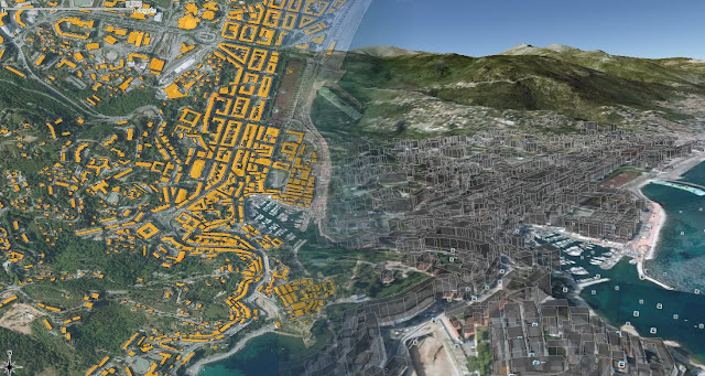
 As I discover the marvels of (geo)R world, I found out this article (link)
It explains how to generate KML files from meuse, the source dataset delivered with sp package, using R software.
In the tutorial, KML files are created from scracth, writing each line of it.OGR driver only gives access to the options name and description (rdgal driver). So, "brute coding" may be necessary if you want to control other elements: color, heights for extruded objects...
Many people would like to visualize some buildings in 3D in google. The reference data that we have for buildings is often plain but there usually is a column specifying the height of each building. For example, for the french BDTOPO, the HAUTEUR column.
